![]()
Bear Mtn: North Buttress
Fraser Valley Regional District County, British Columbia
Uploaded by Bivy Team
15 :18 hrs
19.6 mi
5246 ft
IV
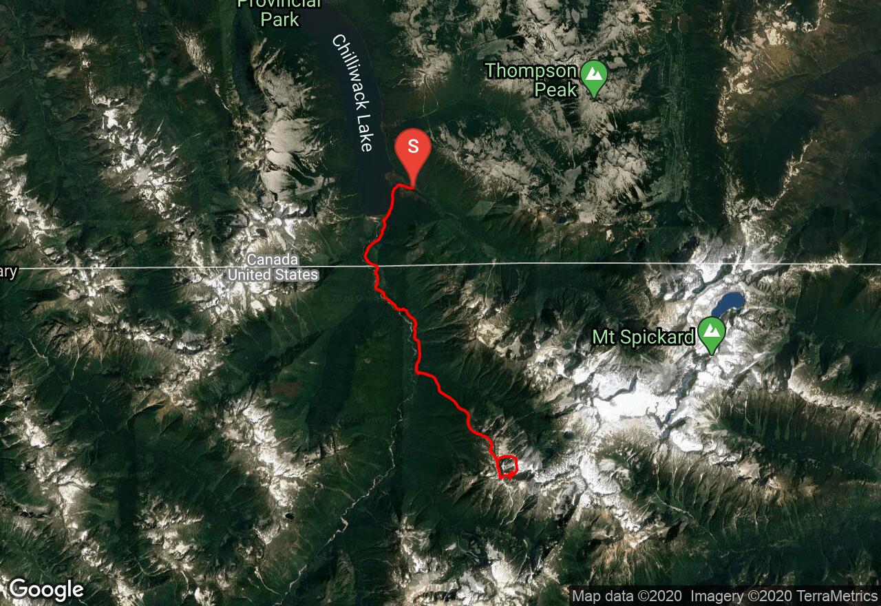
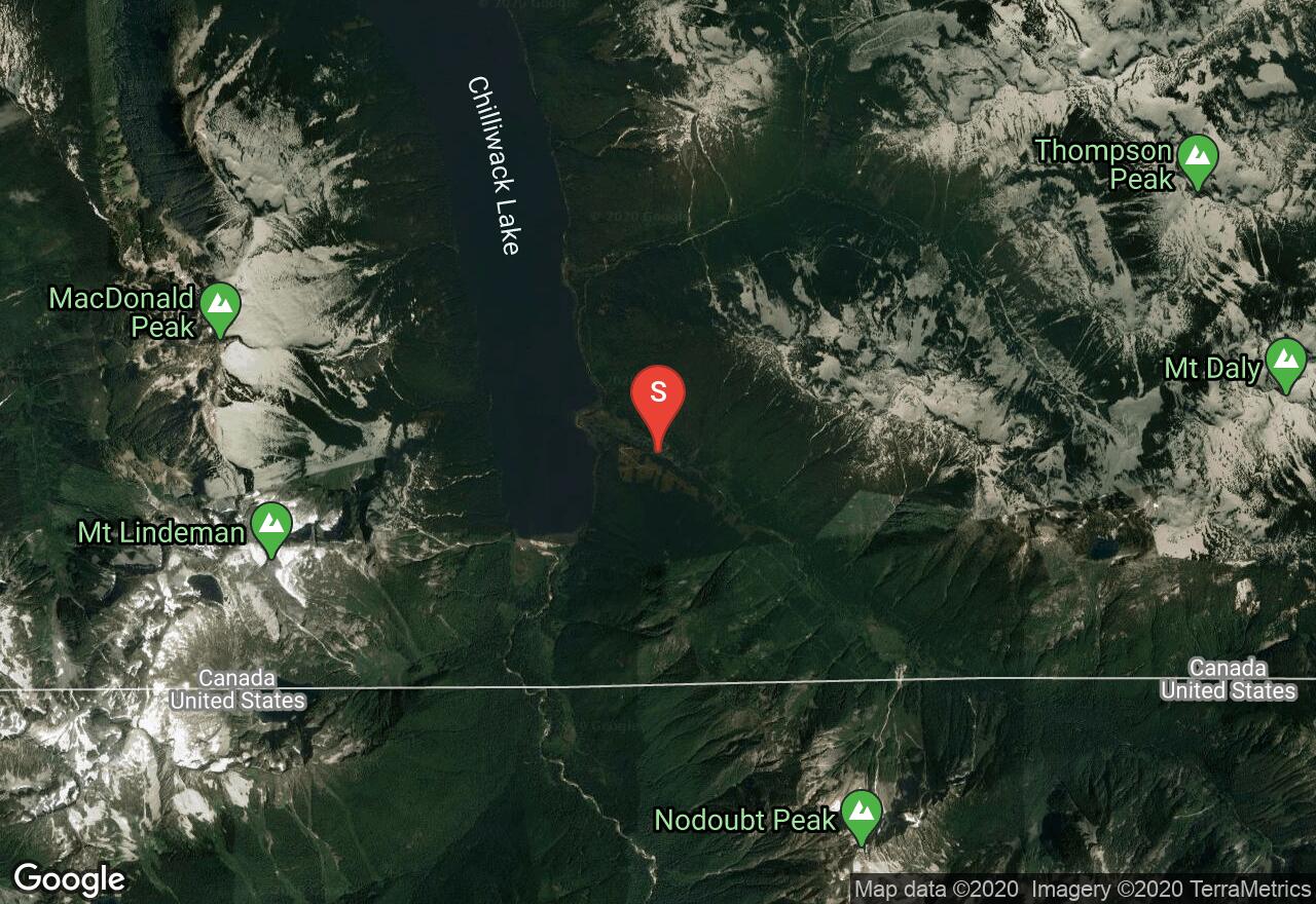
Bear Mtn is a remote and infrequently climbed summit. This is primarily due to its inaccessibility; the North Buttress has some of the most aesthetic and sustained alpine rock climbing in the state. The shortest access route is via the long and bumpy (high clearance recommended) road to Chilliwack Lake in B.C. – obtain North Cascades National Park camping permits in Sedro-Woolley or call the permit office before you embark. Note that crossing the border back into the U.S. on foot is not technically legal. A gate just after the turn-off for Depot Creek Road may be closed, forcing an additional walk of almost 1.5 miles to the south end of Chilliwack Lake. Follow the trail through old-growth forest to the boundary line. The trail deteriorates once in the U.S. and is impossible to follow at times, but improves once in the vicinity of Bear Camp, where you turn east to follow an old fire-break trail up the ridge toward your objective. The trail is very faint and if you get off of it, just follow the ridge top to treeline, then on the south side of some rocky knolls to a flat area near a col at about 6,500 feet. Descend to the north over scree/snow and round the Northwest Buttress, circling back up toward the North Buttress. A direct route has been done from the base of the buttress, but an easier and more established way to go is to begin climbing up a couloir toward "The Diamond," a face of sheer rock due north of the summit. The rock route begins at approximately 6,600 feet or wherever it's convenient to cross onto the buttress (possibly over a moat.) Traverse slabs toward a bench that holds snow year-round and begin climbing on the buttress proper. Approximately 6 pitches of climbing on the crest brings you to a short (optional) downclimb to get off the crest and into a chimney for the remaining 3 pitches to the northwest summit. From this false peak, it's Class 3-4 scrambling to the summit. Descend via the same route to the col between the two summits, then proceed west and south down a moderate slope to a gap in cliffs, then traverse north to return to the 6,500 foot col (a decent place to camp.)
2 photos
[{"url":"https://images.bivy.com/lgMap/605008.jpg"},{"url":"https://images.bivy.com/lgTrailMap/605008.jpg"}]
Bear Mtn: North Buttress | Fraser Valley Regional District County, British Columbia
Bear Mtn is a remote and infrequently climbed summit. This is primarily due to its inaccessibility; the North Buttress has some of the most aesthetic and sustained alpine rock climbing in the state. The shortest access route is via the long and bumpy (high clearance recommended) road to Chilliwack Lake in B.C. – obtain North Cascades National Park camping permits in Sedro-Woolley or call the permit office before you embark. Note that crossing the border back into the U.S. on foot is not technically legal. A gate just after the turn-off for Depot Creek Road may be closed, forcing an additional walk of almost 1.5 miles to the south end of Chilliwack Lake. Follow the trail through old-growth forest to the boundary line. The trail deteriorates once in the U.S. and is impossible to follow at times, but improves once in the vicinity of Bear Camp, where you turn east to follow an old fire-break trail up the ridge toward your objective. The trail is very faint and if you get off of it, just follow the ridge top to treeline, then on the south side of some rocky knolls to a flat area near a col at about 6,500 feet. Descend to the north over scree/snow and round the Northwest Buttress, circling back up toward the North Buttress. A direct route has been done from the base of the buttress, but an easier and more established way to go is to begin climbing up a couloir toward "The Diamond," a face of sheer rock due north of the summit. The rock route begins at approximately 6,600 feet or wherever it's convenient to cross onto the buttress (possibly over a moat.) Traverse slabs toward a bench that holds snow year-round and begin climbing on the buttress proper. Approximately 6 pitches of climbing on the crest brings you to a short (optional) downclimb to get off the crest and into a chimney for the remaining 3 pitches to the northwest summit. From this false peak, it's Class 3-4 scrambling to the summit. Descend via the same route to the col between the two summits, then proceed west and south down a moderate slope to a gap in cliffs, then traverse north to return to the 6,500 foot col (a decent place to camp.)